THE SUFFOLK COUNTY BLUEWAY TRAIL PLAN IS COMPLETE
Thank You For Your Help!
Check this page for updates on implementation.
Email Planning@suffolkcountyny.gov to be placed on an email list for future information
Our Magnificent Waterways

Suffolk County is a unique place, with the Long Island Sound to the north and the Atlantic Ocean to the south – and an abundance of harbors, bays, rivers and lakes, we are home to more than 1,000 miles of shoreline that provides scores of opportunities for recreation and ecotourism. Kayaking, canoeing, paddle boarding and rowing are wonderful ways to get out onto the water for exercise, appreciation of the natural environment or just enjoy a beautiful day on the water!
Suffolk County Launches the Blueway Trail Plan

Suffolk County launched the First Phase of the Suffolk County Blueway Trail Plan on National Canoe Day. The Blueway Trail Plan will make non-motorized water sports: kayaking, canoeing, paddle boarding and rowing more accessible to residents and visitors. Paddlers have long enjoyed the many waterways in Suffolk County, and we want to make it easier for residents and visitors to learn about how more people can take advantage of these sports as another way to enjoy the County’s expanse of shoreline.

A Blueway Trail is similar to a hiking trail, in that it provides suggested routes depending upon skill level and locations of features such as rest stops, scenic locations, good birdwatching and amenities such as restrooms, concessions, nearby businesses and parking. Unlike a hiking trail, a Blueway Trail does not have trail markers along the way, but, it does include wayfinding signage to help paddlers find launch locations and provides information such as maps, environmental educational information and safety information.
Development of the Plan
We have received valuable input from the Public Advisory Committee, various kayaking organizations, environmental groups, active paddlers, and members of the public in developing the Blueway Trail Plan. We participated in several community outreach events and reached out to interested organizations. With this wonderful input from so many we were able to identify over 200 possible launch sites on the more than 1,000 miles of waterfront, lakes and rivers in Suffolk County.
With the input gathered from the various sources we were able to develop an inventory of sites throughout the County. Our next step was to develop and give a ranking to each site based on a specific set of criteria. The criteria used included access to parking; proximity to a downtown area or deli’s and or restaurants; sanitary facilities; ease of launching; ease of access to the water; location of launch site to parking facilities. Of the 200 possible launch sites, the top 25 were identified as sites that deserved further investigation. Representatives from the County, the consultant, various municipalities and environmental groups spent the spring and summer of 2020 performing actual site visits. From Huntington to Montauk each site was photographed, assets of the site were recorded, as well as any issues that would prevent the site from being considered as part of a Blueway Trail and what improvements would be needed to make the site a preferred location.
Another inventory was completed for each of these top sites as well as a “wish list” of improvements that could be part of the next phase of the plan. Upon physical inspection some sites were deemed not eligible as they were not easily accessible while other sites were identified as excellent for non-motorized water craft. Conceptual improvements were identified at the various sites that could include installation of ramps for easier access and ADA accessibility, improved parking facilities and improved sanitary systems.
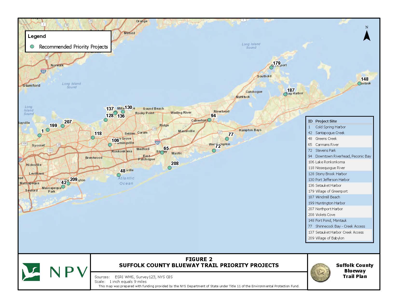
Twenty (20) Priority Launch Locations were identified for the initial Suffolk County Blueway Trail. A map of the Priority Locations is shown here.
For more about the development of recommendations, please see the links below for the presentations from our Plan Advisory Committee meetings and first public meeting.
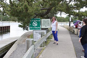
Legislator Kara Hahn joined the group for inspections of sites on the north shore of Brookhaven Town. Stony Brook Harbor.
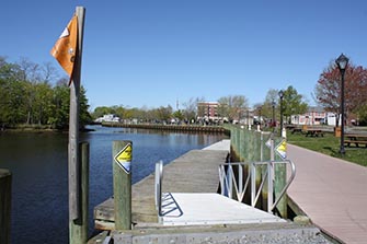
The Town of Riverhead floating dock in Riverfront Park provides an opportunity for a launch site and improvements to provide comfortable and safe access to small boats.
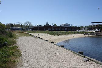
The waterfront park in Sag Harbor provides an opportunity for a Blueway Trail launch as the Village plans improvements to Steinbeck Park.
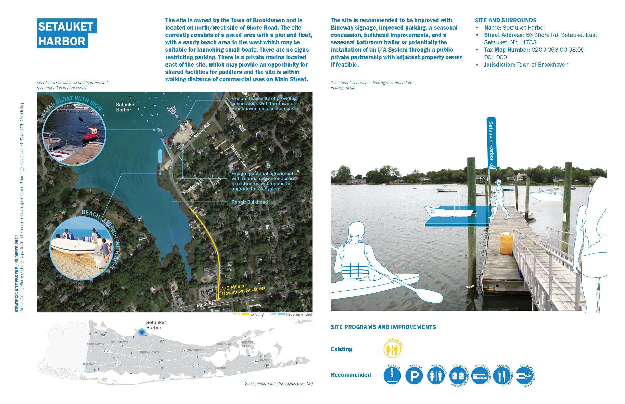
A sample Project Profile is shown here.
The Benefits of Paddling Are Numerous!
It’s good exercise, fun and a great way to appreciate our natural environment.
Additional Blueway Resources
This Blueway Trail project has been funded in part by the New York State Department of State (DOS) under Title 11 of the Environmental Protection Fund.